METRICA SA, in cooperation with the majority of the firms represented, actively supports education offering modern and comprehensive solutions to universities, technical institutes and other organizations whose activity is educational. The training packages are offered special conditions and specifications that fully meet the high standards and needs of each organization.
Visit the relevant website of Leica Geosystems AG or contact us tel: 210 2815440.
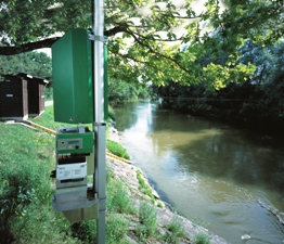
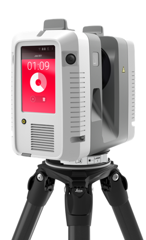
GPS / GNSS Rental, Geodetic Station Rental, Laser Scanner Rental, Environmental Equipment Rental etc.
Do you want to get the most out of your work using all the latest technological tools? Are you a new engineer and have no equipment? Or is your equipment old enough to live up to your expectations?
At METRICA we give importance to the flexibility that every modern professional needs to achieve their goals. Considering the rapid technological developments, the greatest demands in the field, the different applications that you are required to complete, we suggest a wide range of rental solutions.
"Change the way you work, transform yourself into a modern professional.
Take advantage of the benefits of rental services."
Refurbished fleet of receivers GNSS (Full GNSS): Each professional chooses the receiver they want and works with technologically upgraded equipment whenever they wish by choosing the daily, weekly or premium rate, depending on their job requirements.
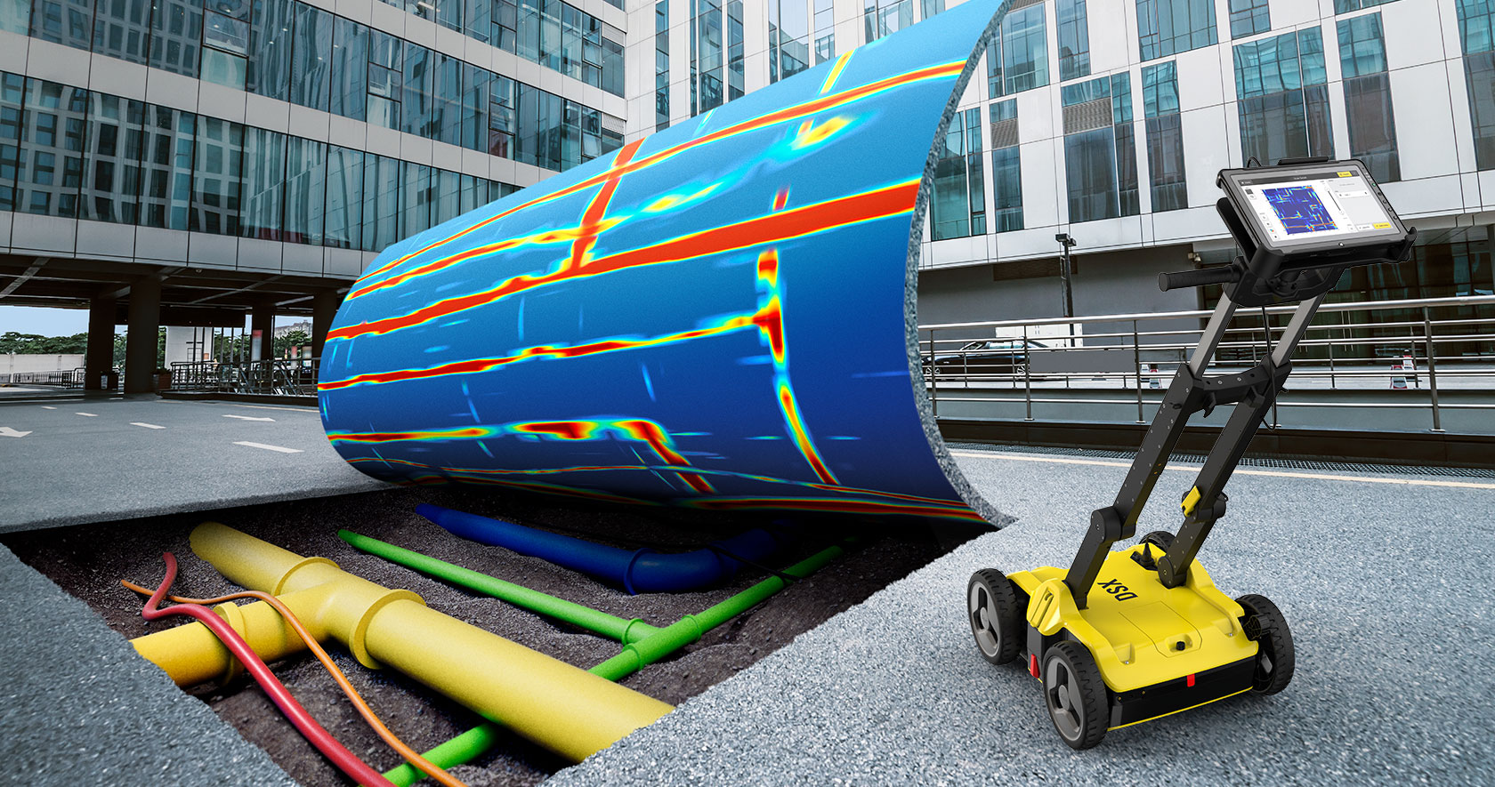
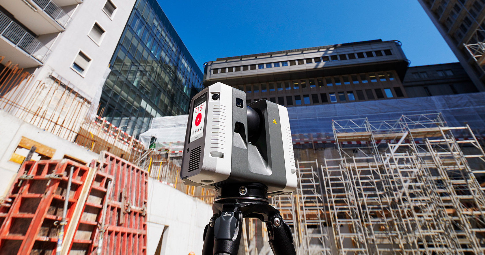
Wide range topographic equipment : Whether it is a simple geodetic station or a MultiStation such as the MS50 with 3D scanning, 3D laser scanner or Drone for aerial mapping, the choice is yours. You can complete any application you wish at any time.
Flexible billing packages, depending on your needs: Not all professionals have the same needs. Daily billing is helpful but not always. At METRICA, we have created different billing packages to cover different work situations throughout Greece. Contact us for more details.
Shipping to any part of Greece: Wherever you are, you can use the rental services and take advantage of the privileges we have set for professionals in the province. Contact us.
Quality guarantee, reliability, service and affordable prices.
Rental services give you the flexibility you need to respond to any application consistently and reliably, using state-of-the-art equipment and sophisticated methodology..
At METRICA SA we have a wide range of equipment to rent for every professional to be able to cover every type of application, from simple survey work to complex measurements in industry and the environment. With every type of equipment you have free educationin the use of instruments, expert advice as well as excellent technical support. You will also find additional services such as data processing, software services, etc.
See here the brochure of basic equipment for rent! Choose from different types of equipment that best suits your needs.
Contact us for any information 210 28 15 440.
To get the most out of your investment
Our customers benefit from Service and Technical Support services that extend beyond geographical boundaries and time zones. Leica Geosystems AG's "Active Customer Care" program includes support packages to suit your needs, whether you use the simplest distance meter or the most sophisticated integrated solution. "Active Customer Care" is a true partnership - it is our commitment to continue to provide that level of Support and Collaboration you expect when you trust us.
The benefits of support contracts at a glance:
Problematic use of the equipment and minimal maintenance-repair delay
Instant update on new features and free software upgrade
An open line of communication throughout the term of the contract
Extension of the guarantee (depending on the type of contract)
Discounts on repairs and spare parts
Free shipping of your equipment after maintenance or repair (depending on the type of contract)
Attend training seminars (when they are held)
Συμβόλαια Leica Geosystems Support
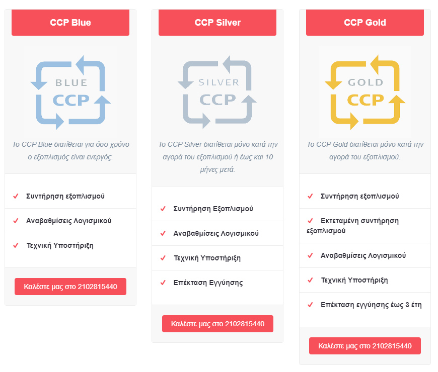
Detailed description of the services listed in the CCP:
Regular Equipment Maintenance:Regular annual maintenance is carried out by specialized technicians trained in the technical laboratory of Leica Geosystems AG in Switzerland with a long experience. The maintenance and inspection certificate provided ensures the optimum performance of your equipment. Complete protocol is maintained during the annual maintenance, all necessary adjustments and controls are made (lubrication, replacement of damaged parts, etc.).
Extended Equipment Maintenance: For greater "peace of mind" Leica Geosystems AG recommends extensive equipment maintenance every 3 years. This includes yearly maintenance with the certificate of inspection and ADDITIONAL full maintenance (includes replacement of worn parts, reconditioning etc.).
Software update: It ensures that you keep up-to-date with the latest versions of applications firmware for maximum productivity.
Technical assistance: Phone access to experienced, trained professionals who will work with you to solve any problem that arises using modern methods and tactics. This service can be used for troubleshooting, equipment configuration and general advice.
Warranty Extension: All Leica Geosystems AG topographic equipment is provided with a one year warranty. This warranty can be extended up to a maximum of 3 years. Work and spare parts are fully covered.
Support Contracts METRICA
The METRICA support contracts are designed to fully meet the daily needs of both SmartNet Greece users and all users of Leica Geosystems AG's GNSS GPS stations or GPS receivers who wish to have full support at every stage of their business.
In summary, with the selection of specific technical support packages, users
They have immediate support when they need it.
They receive tips and guidance on resolving technical issues
They receive all software upgrades
They can check that their equipment is functioning for FREE
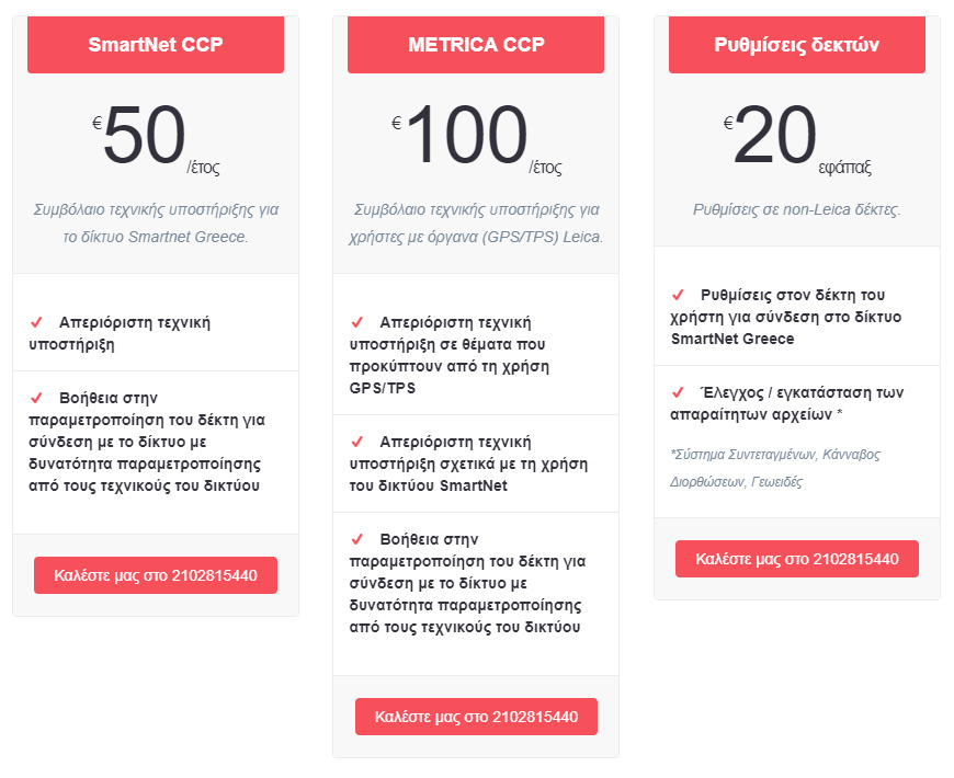
Detailed description of the services listed in the METRICA Support Contracts
Settings on non-Leica receivers: Create settings for the receiver to connect to the SmartNet Greece network and check / install the necessary files for any available receivers (Coordinate System, Cannabis Correction, Geoid). Arrangements are made by technical staff at METRICA offices. Otherwise the user should contact the company that purchased the receiver or consult the posted instructions in the "Frequently Asked Questions" section. Receiver settings are not made by phone.
SmartNet CCP: Annual network technical support contract for all users.
Metrica CCP: Annual technical support contract for instrument users (GPS / TPS) Leica Geosystems AG. It includes support for issues arising from the use of equipment such as instructions for downloading data, LGO software support, and more. as well as being included in the SmartNet CCP.
FREE services:
Free Technical Support via e-mail for all users. Send requests to the email address This email address is being protected from spambots. You need JavaScript enabled to view it.. Service within 24 hours.
Free update on network status by region.
METRICA A.E. maintains a certified SERVICE lab with specialized staff trained annually on new technologies in the manufacturers' laboratories we represent. Leica Geosystems AG's official laboratory certification was obtained by our laboratory for the first time in 2006 and since then we have been part of the official network of approximately 130 certified laboratories worldwide with the title:
Authorized Service Center of Leica Geosystems AG
Avaliable Services
Control and setting: The first and simplest step to ensure your equipment is in good condition is to fix its basic faults (horizontal, vertical, etc.).
Regular Equipment Maintenance:Regular annual maintenance is carried out by specialized technicians trained in the technical laboratory of Leica Geosystems AG in Switzerland with a long experience. The maintenance and inspection certificate provided ensures the optimum performance of your equipment. Complete protocol is maintained during the annual maintenance, all necessary adjustments and controls are made (lubrication, replacement of damaged parts, etc.).
Extensive Equipment Maintenance: For greater "peace of mind" Leica Geosystems AG recommends extensive equipment maintenance every 3 years. This includes yearly maintenance with the certificate of inspection and ADDITIONAL full maintenance (includes replacement of worn out parts, reconditioning etc.).
Software update:It ensures that you keep up-to-date with the latest versions of applications firmware for maximum productivity.
Extension of Warranty: All Leica Geosystems AG topographic equipment is provided with a one year warranty. This warranty may be extended to a maximum of three (3) years. Work and spare parts are fully covered. So you have your "head quiet" about any problems that may arise.
Calibrations: The service laboratory operates a dedicated geodetic station and GPS calibration facility with three calibrated bases for the control of angles, distances and the accuracy of GPS measurements approved by Leica Geosystems AG to certify the instruments necessary for the controls. ISO. The calibration bases shall be tested in accordance with the procedures of ISO 17123-3 &17123-4 for TPS and ISO 17123-8 based on Leica Geosystems AG GPS. The calibration bases are checked monthly with the Metrology Instrument, Laser Tracker, Leica AT402.
Based on the above, both control certificates and calibration certificates are issued for ISO audits.
Our company operates a fully equipped repair department, capable of meeting any need for maintenance or repair of your Leica topographic equipment, from a simple surveyor to the latest high-tech GPS and Geodetic stations. The laboratory fully complies with the rules and strict procedures set out above.
Calibration Services
Certified by Leica Geosystems AG, a SERVICE laboratory of our company, there is an angular surveying and calibration system installed as well as a distance calibration system. The installation consists of five special collimators positioned at different angles around a fixed calibration base.
The geodetic station is mounted on the base and checked three times by creating three sets of measurements in different areas of the horizontal and vertical discs of the instrument, in the first and second telescope positions, using a special software that ensures accurate and smooth measurement results.
Correspondingly, for distance calibration the Geodetic Station is also placed on a special, fixed basis and three sets of measurements are made at three constant distances. There are three sets of measurements in prisms, three sets of self-adhesive targets and three sets of Reflectorless mode, for those instruments that support it. Measurements are made at both telescope positions resulting in 18 measurements in total, which yields the statistical result (standard deviation). The above method, approved by Leica Geosystems AG, enables us to test and certify all Geodetic Stations. , regardless of manufacturer at both angles and distances.
The SERVICE Lab also has a dedicated geodetic station and GPS calibration facility with three calibrated bases for checking the angles, distances and accuracy of GPS measurements approved by Leica Geosystems AG to certify the instruments necessary for the controls. ISO. Calibration bases shall be tested in accordance with the procedures of ISO 17123-3 &17123-4 for TPS and ISO 17123-8 based on Leica Geosystems AG GPS.
The calibration bases are checked monthly with a Metrology Instrument, Laser Tracker, Leica AT402.
The HxGN SmartNet is the GNSS correction service based on the largest network of reference stations worldwide. Allows GNSS-enabled devices to quickly determine positions accurately 1-2 centimeters. The service is available 24 hours to 24 hours from a high availability infrastructure and a professional support team with more than 10 years to provide reliable service.
Innovations
The HxGN SmartNet gives users the ability to use the Beidou satellite formation while covering all of Greece with RTK - NRTK accuracy (1 - 3 cm 3D).
It addresses all geodetic GPS users, regardless of manufacturer, and increases productivity in most (for RTK subscriptions receivers must support GPRS - NTRIP protocol).
For use satellites Beidou , the HxGNSmartNet supports data format i-MAX (receivers Leica Geosystems AG). Any market receiver supports this format data can use that satellite formation reaping all the benefits arising from its use.
For new users of our network is possible "trial" period of 7 days and available flexible packages designed to meet the different needs of users.
Advantages SmartNet Greece:
Using satellite formation BeiDou: The network stations have been upgraded and now supports and satellites BeiDou who have several advantages for network users such as increased availability of satellites, problem even in areas that were not possible, etc.
Certification: is the only network that is resolved annually since Aristotle and ensures maximum accuracy and coincidence with the coordinates of HEPOS the order of 4 mm.
Flexibility: It offers several different subscription packages designed to meet the different needs of users.
Smart & easy online management via special software that makes use of real-time control routine.
Reduce errors using different network techniques MAX, FKP, iMAX, VRS throughout mainland Greece, the Ionian Islands and the Cyclades and Single Base data on individual islands.
Providing post-processing services such as downloading of static observations (RINEX - VRINEX) and resolution observations (Computation Service).
Unparalleled technical support: Effective communication & support to qualified personnel field.
Network solution (NRTK) VS Solving from a station (RTK - Single Base)
The advantages of the former is significantly technical and technological level. Specifically, the use of offers users:
Larger coverage with the result that the user can work on the entire surface being coated by cycles of more than 60 km radius (GNSS receivers) to reference stations center.
Greater accuracy RTK data, said resolving more bases thus obtained better geometry (triangulation).
Better undo the atmospheric errors due to ionospheric model creation in the coverage of permanent reference station area.
The management of reference stations as a network of Leica SpiderNet software and the ability to export reports (log reports) with abundance of detail as to the reliability of the measurements, the satellite health, and more.
Learn about the possible ways of connecting the HxGN SmartNet network, and transformations for converting coordinates in Greek EGSA system 87:
1RTK – NTRIP, real-time corrections via GPRS Internet.
2Post Processing data for subsequent resolution measurements in the office.
3Real Time DGPS via NTRIP corrections to bases greater than 60km (typically) from the nearest reference station.
For more information visit the following link: https://hxgnsmartnet.com/el-gr
Note:The network is aimed at all users of GPS Devices regardless of manufacturer and maximizes productivity (for RTK subscriptions the receivers must support GPRS - NTRIP protocol). The use of the Network Services implies the express and unconditional acceptance of the terms and conditions governing its operation. The Terms of Use are published on www.metrica.gr and are available from METRICA SA. to any interested party./
Strategic partnership
The agreement with Leica Geosystems and Smartnet Europe makes HxGN SmartNet network member of the first resulting in continuous monitoring, support, full access to new versions of SW and new technology..
Cooperation with Bulgaria's reference station network HxGN SmartNet for data exchange.
National Observatory of Athens - Exchange of data and control network. The PONT stations, PRVK, LEMN, KASI, VLSM belong to NOA and incorporated in HxGN SmartNet contract basis network. Also in cooperation with SA the KRPS stations, NEAB and SKYR have installed. These receptors belong to HxGN SmartNet network and installed at points selected by NOA which has arranged for the hospitality and telemetry.
AUTH - Continuous monitoring of reference stations, creating a single transformation and certification network.
the MetricaNet network data will receive officially two foreign universities (University of Nevada, University of Arizona) to conduct research for the development of seismic modeling world and the «Istituto Nazionale di Geofisica e Vulcanologia» based in Bologna, Italy.
Providing data network for educational and research purposes: the University of Patras - Department of Geology at the Institute of Geodesy, Topography and Cartography and Pecný Observatory and at the Charles University in Prague (Dep. Of Geophysics). Within these partnerships belonging and inclusion of 3 new stations in HxGN SmartNet network in Agrinio-Mesologi area.

